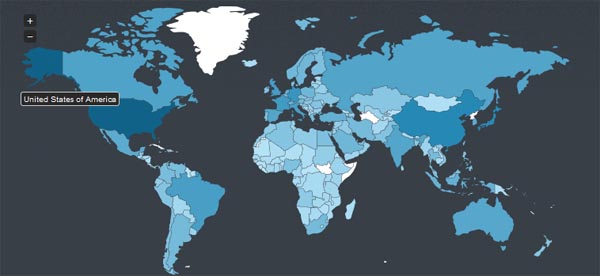
jVectorMap is a jQuery plugin that used to show vector maps and visualize data on HTML pages. It renders SVG and VML vector maps in all modern browsers ranging from the ancient Internet Explorer 6 to latest modern borwser like Firefox , Safari, Chrome, Opera.
Using jVectorMap is very simple and easily, you just create an html file include JavaScript and CSS files. While initializing map you can also provide parameters to change its look and feel easily.
You can handle various events from the map like hovers, clicks, and label displaying using documented API
Vector world map, world regions, countries and cities are available for download from the official site of jVectorMap.
jVectorMap using ISO-3166 standard for identification of the countries and regions. jVectorMap consists of two modules: maps converter written in Python and jQuery plug-in which renders maps and provides JavaScript API to control them.


You can find a nice example of jvectormap on Global Quiz. The site provides knowledge maps, created basing on the submitted quiz answers. Works and looks nicely.